|
The Division of Water Resources (DWR) provides the data contained within this
Local Water Supply Plan (LWSP) as a courtesy and service to our customers.
DWR staff does not field verify data. Neither DWR, nor any other party
involved in the preparation of this LWSP attests that the data is completely
free of errors and omissions. Furthermore, data users are cautioned that
LWSPs labeled PROVISIONAL have yet to be reviewed by DWR staff. Subsequent
review may result in significant revision. Questions regarding the accuracy
or limitations of usage of this data should be directed to the water system
and/or DWR.
1. System Information
Contact Information
Complete
| Water System Name: |
Iredell Water Corporation |
|
PWSID: |
01-49-025 |
| Mailing Address: | P. O. Box 1844
Statesville, NC 28687-1844 | Ownership: | Non-Profit |
| |
| Contact Person: | Danny Sloan | Title: | General Manager/ CEO |
| Phone: | 704-876-0672 | Cell/Mobile: | -- |
Distribution System
| Line Type |
Size Range (Inches) |
Estimated % of lines |
| Asbestos Cement |
6-12 |
7.00 % |
| Ductile Iron |
3-12 |
1.00 % |
| Galvanized Iron |
2 |
0.04 % |
| Other |
8 |
0.06 % |
| Polyvinyl Chloride |
2-12 |
91.90 % |
Mains replaced Were Rocky Creek Crossing in Turnersburg and Jennings Rd for NCDOT Bridge project B-5846
New mains reflect new development Sullivan Farm
**Iredell Water does not operate a wastewater system and most users have private septic systems. While we do install irrigation only meters, many older meters were installed for both potable and irrigation use. This is an unknown figure so zero is entered. There are two municipalities that operate wastewater systems in our service area Programs
Water Conservation
2. Water Use Information
Service Area
| Sub-Basin(s) | % of Service Population |
|---|
| South Yadkin River (18-2) | 100 % |
|
| County(s) | % of Service Population |
|---|
| Iredell | 100 % |
|
As of December 31, 2024 Iredell Water served 10,937 active services. Population is derived by multiplying active services by 2.5 Water Use by Type
| Type of Use |
Metered
Connections |
Metered
Average Use (MGD) |
Non-Metered
Connections |
Non-Metered
Estimated Use (MGD) |
| Residential |
10,307 |
1.4180 |
0 |
0.0000 |
| Commercial |
486 |
0.3080 |
0 |
0.0000 |
| Industrial |
17 |
0.0930 |
0 |
0.0000 |
| Institutional |
127 |
0.0790 |
0 |
0.0000 |
How much water was used for system processes (backwash, line cleaning, flushing, etc.)? 0.0244 MGD
Residential includes single family residences and all irrigation
Commercial Includes all commercial, fire protection, agricultural, and multi-family
19,000 per day for cL2 analyzers (0.019 mgd)
2.0M gals for scheduled flushing/washouts throughout the year (0.00546) Water Sales
| Purchaser |
PWSID |
Average
Daily Sold
(MGD) |
Days
Used |
Contract |
Required to
comply with water
use restrictions? |
Pipe Size(s)
(Inches) |
Use
Type |
| MGD |
Expiration |
Recurring |
| CHIPLEY PARK SD |
01-49-106 |
0.0095 |
3 |
0.0000 |
|
No |
Yes |
2 |
Regular |
| RIVER HILL HEIGHTS S/D |
01-49-133 |
0.0038 |
366 |
0.0000 |
|
No |
Yes |
2 |
Regular |
Total usage:
Chipley Park= 28,562 for 3 days
River Hill= 1,402,126 for 366 days 3. Water Supply Sources
Monthly Withdrawals & Purchases
|
Average Daily
Use (MGD) |
Max Day
Use (MGD) |
|
Average Daily
Use (MGD) |
Max Day
Use (MGD) |
|
Average Daily
Use (MGD) |
Max Day
Use (MGD) |
| Jan |
2.2040 |
2.4620 |
May |
2.2950 |
2.5300 |
Sep |
2.4510 |
2.7640 |
| Feb |
2.0830 |
2.2110 |
Jun |
2.6920 |
3.1720 |
Oct |
2.4960 |
2.8230 |
| Mar |
2.0400 |
2.2510 |
Jul |
2.6130 |
3.1230 |
Nov |
2.2640 |
2.5550 |
| Apr |
2.2440 |
2.7130 |
Aug |
2.3790 |
2.6280 |
Dec |
2.0880 |
2.2770 |

Ground Water Sources
| Name or Number |
Average Daily Withdrawal (MGD) |
Max Day Withdrawal (MGD) |
12-Hour Supply
(MGD) |
CUA Reduction |
Year Offline |
Use Type |
| MGD |
Days Used |
| E01 |
0.1360 |
366 |
0.178 |
0.1836 |
|
|
Regular |
| E02 |
0.1540 |
366 |
0.189 |
0.1584 |
|
|
Regular |
| E04 |
0.0710 |
355 |
0.112 |
0.0914 |
|
|
Regular |
| E05 |
0.0200 |
366 |
0.035 |
0.0533 |
|
|
Regular |
| E06 |
0.0190 |
341 |
0.057 |
0.0907 |
|
|
Regular |
| E10 |
0.0920 |
366 |
0.199 |
0.3024 |
|
|
Regular |
| E11 |
0.0280 |
357 |
0.046 |
0.0302 |
|
|
Regular |
| E12 |
0.0690 |
365 |
0.083 |
0.0792 |
|
|
Regular |
| E13 |
0.0390 |
364 |
0.060 |
0.1008 |
|
|
Regular |
| E14 |
0.0180 |
355 |
0.036 |
0.1195 |
|
|
Regular |
| E15 |
0.0480 |
366 |
0.085 |
0.0907 |
|
|
Regular |
| E16 |
0.0330 |
357 |
0.039 |
0.0806 |
|
|
Regular |
| E18 |
0.0340 |
366 |
0.036 |
0.0907 |
|
|
Regular |
| E19 |
0.0150 |
365 |
0.023 |
0.0281 |
|
|
Regular |
| E20 |
0.1010 |
362 |
0.134 |
0.1440 |
|
|
Regular |
| E21 |
0.1130 |
366 |
0.148 |
0.1260 |
|
|
Regular |
| E22 |
0.0330 |
354 |
0.043 |
0.1044 |
|
|
Regular |
| E23 |
0.0020 |
365 |
0.005 |
0.0238 |
|
|
Regular |
| E25 |
0.0250 |
340 |
0.043 |
0.1476 |
|
|
Regular |
| E26 |
0.1130 |
366 |
0.144 |
0.1728 |
|
|
Regular |
| E27 |
0.0410 |
366 |
0.086 |
0.1044 |
|
|
Regular |
| E28 |
0.0870 |
362 |
0.140 |
0.2376 |
|
|
Regular |
| E29 |
0.0310 |
358 |
0.046 |
0.2088 |
|
|
Regular |
| E30 |
0.0180 |
356 |
0.022 |
0.0288 |
|
|
Regular |
| E31 |
0.0390 |
360 |
0.049 |
0.0936 |
|
|
Regular |
| E32 |
0.0320 |
360 |
0.051 |
0.0720 |
|
|
Regular |
| E33 |
0.0940 |
348 |
0.134 |
0.1404 |
|
|
Regular |
| E34 |
0.0210 |
366 |
0.024 |
0.0756 |
|
|
Regular |
| E35 |
0.1040 |
364 |
0.203 |
0.2304 |
|
|
Regular |
| E36 |
0.0130 |
364 |
0.015 |
0.0288 |
|
|
Regular |
| E37 |
0.0800 |
354 |
0.122 |
0.0972 |
|
|
Regular |
| E38 |
0.1580 |
366 |
0.250 |
0.3132 |
|
|
Regular |
| E39 |
0.2040 |
366 |
0.296 |
0.2909 |
|
|
Regular |
| E40 |
0.0690 |
366 |
0.174 |
0.1620 |
|
|
Regular |
| E43 |
0.0530 |
358 |
0.137 |
0.1037 |
|
|
Regular |
| E44 |
0.0470 |
352 |
0.090 |
0.1008 |
|
|
Regular |
Ground Water Sources (continued)
| Name or Number |
Well Depth (Feet) |
Casing Depth
(Feet) |
Screen Depth (Feet) |
Well Diameter (Inches) |
Pump Intake Depth (Feet) |
Metered? |
| Top |
Bottom |
| E01 |
460 |
81 |
0 |
0 |
6 |
147 |
Yes |
| E02 |
605 |
88 |
0 |
0 |
8 |
126 |
Yes |
| E04 |
605 |
52 |
0 |
0 |
8 |
315 |
Yes |
| E05 |
825 |
133 |
|
|
8 |
505 |
Yes |
| E06 |
307 |
40 |
0 |
0 |
6 |
147 |
Yes |
| E10 |
245 |
31 |
0 |
0 |
8 |
126 |
Yes |
| E11 |
905 |
52 |
|
|
8 |
315 |
Yes |
| E12 |
315 |
111 |
0 |
0 |
6 |
210 |
Yes |
| E13 |
305 |
50 |
0 |
0 |
8 |
147 |
Yes |
| E14 |
345 |
86 |
0 |
0 |
8 |
315 |
Yes |
| E15 |
315 |
111 |
0 |
0 |
6 |
273 |
Yes |
| E16 |
190 |
40 |
0 |
0 |
6 |
168 |
Yes |
| E18 |
142 |
37 |
0 |
0 |
6 |
126 |
Yes |
| E19 |
505 |
85 |
0 |
0 |
6 |
315 |
Yes |
| E20 |
805 |
53 |
|
|
8 |
200 |
Yes |
| E21 |
905 |
70 |
0 |
0 |
8 |
210 |
Yes |
| E22 |
405 |
108 |
0 |
0 |
6 |
210 |
Yes |
| E23 |
545 |
83 |
0 |
0 |
6 |
504 |
Yes |
| E25 |
425 |
47 |
0 |
0 |
8 |
210 |
Yes |
| E26 |
405 |
52 |
0 |
0 |
8 |
231 |
Yes |
| E27 |
565 |
60 |
0 |
0 |
8 |
504 |
Yes |
| E28 |
305 |
52 |
0 |
0 |
8 |
189 |
Yes |
| E29 |
385 |
64 |
0 |
0 |
8 |
315 |
Yes |
| E30 |
725 |
57 |
0 |
0 |
8 |
244 |
Yes |
| E31 |
565 |
53 |
0 |
0 |
8 |
294 |
Yes |
| E32 |
725 |
94 |
0 |
0 |
8 |
609 |
Yes |
| E33 |
825 |
70 |
0 |
0 |
8 |
399 |
Yes |
| E34 |
825 |
71 |
|
|
8 |
147 |
Yes |
| E35 |
485 |
70 |
|
|
8 |
315 |
Yes |
| E36 |
985 |
52 |
|
|
8 |
609 |
Yes |
| E37 |
645 |
164 |
|
|
8 |
546 |
Yes |
| E38 |
547 |
68 |
|
|
8 |
399 |
Yes |
| E39 |
750 |
64 |
|
|
8 |
336 |
Yes |
| E40 |
905 |
85 |
|
|
8 |
357 |
Yes |
| E43 |
1005 |
67 |
|
|
8 |
462 |
Yes |
| E44 |
765 |
65 |
|
|
8 |
462 |
Yes |
IWC is currently monitoring ground water levels at 16 wells. Levels are monitored continuously through the SCADA system.
Our Wellhead Protection Plan was most recently approved in 2021.
12 hour supply were all researched and updated to match 24 hour pump records on file. If no record of 24hr pump test was found we used the approved yield recorded in NCDEQ Drinking Water Watch. Water Purchases From Other Systems
| Seller |
PWSID |
Average
Daily Purchased
(MGD) |
Days
Used |
Contract |
Required to
comply with water
use restrictions? |
Pipe Size(s)
(Inches) |
Use
Type |
| MGD |
Expiration |
Recurring |
| City of Statesville (James Farm) |
01-49-010 |
0.1220 |
104 |
1.0000 |
2122 |
No |
Yes |
6 |
Regular |
| City of Statesville (Salisbury Hwy) |
01-49-010 |
0.0700 |
110 |
|
|
|
Yes |
8 |
Regular |
| Energy United WC |
01-02-015 |
0.0180 |
366 |
0.0000 |
2037 |
No |
Yes |
6 |
Regular |
Figures below directly from our 2024 NCDEQ Monthly Operating Reports:
Energy United Water Purchase = 6,653,000 gals.total used 366 days
James Farm Connection total was 12,724,591 gals for 104 days used.
Wayside Connection total was 7,726,266 gals for 110 days used.
In 2023 a new Water Supply and Purchase Agreement was entered into with the City of Statesville with a 99-year term to allow for purchase of 31 million gallons per month. 4. Wastewater Information
Monthly Discharges
|
Average Daily
Discharge (MGD) |
|
Average Daily
Discharge (MGD) |
|
Average Daily
Discharge (MGD) |
| Jan |
0.0000 |
May |
0.0000 |
Sep |
0.0000 |
| Feb |
0.0000 |
Jun |
0.0000 |
Oct |
0.0000 |
| Mar |
0.0000 |
Jul |
0.0000 |
Nov |
0.0000 |
| Apr |
0.0000 |
Aug |
0.0000 |
Dec |
0.0000 |
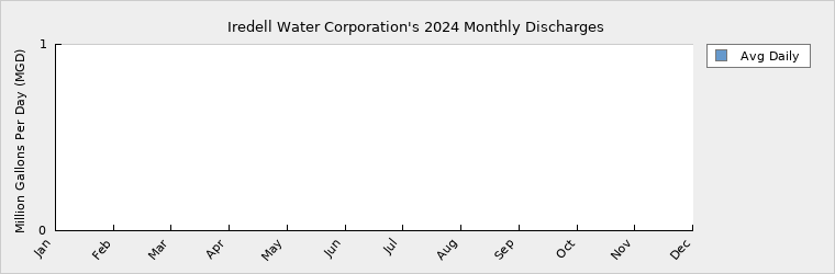
Iredell Water does not operating any waste water facilities and does not track septic system. 5. Planning
Projections
| |
2024 |
2030 |
2040 |
2050 |
2060 |
2070 |
| Year-Round Population |
27,343 |
30,718 |
36,344 |
41,969 |
47,595 |
53,220 |
| Seasonal Population |
0 |
0 |
0 |
0 |
0 |
0 |
| |
| Residential |
1.4180 |
1.5055 |
1.7472 |
2.0277 |
2.3531 |
2.7309 |
| Commercial |
0.3080 |
0.3670 |
0.4650 |
0.5630 |
0.6620 |
0.7600 |
| Industrial |
0.0930 |
0.1220 |
0.1700 |
0.2180 |
0.2670 |
0.3150 |
| Institutional |
0.0790 |
0.0740 |
0.0760 |
0.0780 |
0.0800 |
0.0820 |
| System Process |
0.0244 |
0.0350 |
0.0450 |
0.0540 |
0.0640 |
0.0730 |
| Unaccounted-for |
0.3774 |
0.4646 |
0.5526 |
0.6490 |
0.7547 |
0.8741 |
1. Data Analysis: Historical data from 2013 to 2024 was analyzed for trends.
2. Average Yearly Growth Calculation: The average yearly growth rate was computed for each category based on historical data.
3. Linear Projection: Using these growth rates, values were projected from 2025 onward to 2070.
Future Supply Sources
| Source Name |
PWSID |
Source Type |
Additional Supply |
Year Online |
Year Offline |
Type |
| E41 |
01-49-025 |
Ground |
0.0576 |
2027 |
|
Regular |
| E45 |
01-49-025 |
Ground |
0.1548 |
2025 |
|
Regular |
| E46 |
01-49-025 |
Ground |
0.0850 |
2026 |
|
Regular |
| E48 |
01-49-025 |
Ground |
0.0504 |
2026 |
|
Regular |
| E49 |
01-49-025 |
Ground |
0.0900 |
2027 |
|
Regular |
| E50 |
01-49-025 |
Ground |
0.1764 |
2025 |
|
Regular |
Demand v/s Percent of Supply
| |
2024 |
2030 |
2040 |
2050 |
2060 |
2070 |
| Surface Water Supply |
0.0000 |
0.0000 |
0.0000 |
0.0000 |
0.0000 |
0.0000 |
| Ground Water Supply |
4.5064 |
4.5064 |
4.5064 |
4.5064 |
4.5064 |
4.5064 |
| Purchases |
1.0880 |
1.0880 |
1.0700 |
1.0700 |
1.0700 |
1.0700 |
| Future Supplies |
0.6142 |
0.6142 |
0.6142 |
0.6142 |
0.6142 |
| Total Available Supply (MGD) |
5.5944 |
6.2086 |
6.1906 |
6.1906 |
6.1906 |
6.1906 |
| Service Area Demand |
2.2998 |
2.5681 |
3.0558 |
3.5897 |
4.1808 |
4.8350 |
| Sales |
0.0039 |
0.0133 |
0.0133 |
0.0133 |
0.0133 |
0.0133 |
| Future Sales |
0.0000 |
0.0000 |
0.0000 |
0.0000 |
0.0000 |
| Total Demand (MGD) |
2.3037 |
2.5814 |
3.0691 |
3.6030 |
4.1941 |
4.8483 |
| Demand as Percent of Supply |
41% |
42% |
50% |
58% |
68% |
78% |

The purpose of the above chart is to show a general indication of how the long-term per capita water demand changes over time. The per capita water demand may actually be different than indicated due to seasonal populations and the accuracy of data submitted. Water systems that have calculated long-term per capita water demand based on a methodology that produces different results may submit their information in the notes field.
Your long-term water demand is 52 gallons per capita per day. What demand management practices do you plan to implement to reduce the per capita water demand (i.e. conduct regular water audits, implement a plumbing retrofit program, employ practices such as rainwater harvesting or reclaimed water)? If these practices are covered elsewhere in your plan, indicate where the practices are discussed here.
NO changes
Are there other demand management practices you will implement to reduce your future supply needs?
What supplies other than the ones listed in future supplies are being considered to meet your future supply needs? Iredell Water Corporation is currently conducting a Water Treatment Plant Feasibility Study which should be completed by early 2026. This study includes local stake holder meetings with surrounding utilities and will look at options of additional well supply, new surface treatment plant(s), and purchase sources and if /how we may partner with other local utilities to plan for future water supplies in our area.
How does the water system intend to implement the demand management and supply planning components above?
Additional Information
Has this system participated in regional water supply or water use planning? No
What major water supply reports or studies were used for planning?
Please describe any other needs or issues regarding your water supply sources, any water system deficiencies or needed improvements (storage, treatment, etc.) or your ability to meet present and future water needs. Include both quantity and quality considerations, as well as financial, technical, managerial, permitting, and compliance issues:
The Division of Water Resources (DWR) provides the data contained within this
Local Water Supply Plan (LWSP) as a courtesy and service to our customers.
DWR staff does not field verify data. Neither DWR, nor any other party
involved in the preparation of this LWSP attests that the data is completely
free of errors and omissions. Furthermore, data users are cautioned that
LWSPs labeled PROVISIONAL have yet to be reviewed by DWR staff. Subsequent
review may result in significant revision. Questions regarding the accuracy
or limitations of usage of this data should be directed to the water system
and/or DWR.
|