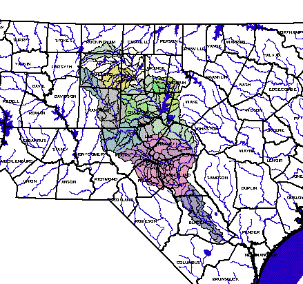
 The study area encompasses the entire Cape Fear River Basin from the
headwaters in Rockingham and Forsyth Counties, downstream past Jordan Lake and to Lock and
Dam No. 1 near Wilmington. This includes the entire portion of the Cape Fear
River that is not influenced by tides from the Atlantic Ocean.
The study area encompasses the entire Cape Fear River Basin from the
headwaters in Rockingham and Forsyth Counties, downstream past Jordan Lake and to Lock and
Dam No. 1 near Wilmington. This includes the entire portion of the Cape Fear
River that is not influenced by tides from the Atlantic Ocean.
The Cape Fear River, while situated wholly within the State, is also
the largest watershed in North Carolina. The river arises in the north central Piedmont
near Greensboro and empties into the ocean below Wilmington. The total catchment area is
9,324 sq. mi., or 16.5% of the total landmass of the state. Of that total, about 5,255 sq.
mi. lie within the immediate study area above Lock & Dam #1. With 6,204 stream
miles, the Cape Fear River is also the most extensive river system in the state.
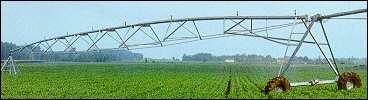 The Cape Fear River basin hosts
a wide variety of land uses. These include the largest concentration of hog farms in the
United States centered on Duplin and Sampson Counties. In addition, there are 114
municipalities within the catchment area, including large urban centers such Greensboro,
Fayetteville and Wilmington. People within the watershed and in adjoining regions depend
on the river for water supply, wastewater assimilation, power generation, navigation,
recreation and other purposes.
The Cape Fear River basin hosts
a wide variety of land uses. These include the largest concentration of hog farms in the
United States centered on Duplin and Sampson Counties. In addition, there are 114
municipalities within the catchment area, including large urban centers such Greensboro,
Fayetteville and Wilmington. People within the watershed and in adjoining regions depend
on the river for water supply, wastewater assimilation, power generation, navigation,
recreation and other purposes.
Go to Top